Deciphering Nature

In this blog you will find an interpretation of scientific data obtained through biological, physical, chemical, geological, astronomical and mathematical research. Everything is real, … however the way the story is told may be different of the one you have been listening over the years. At the end of each article you will find bibliography that will allow you to explore these fields by yourself. Hope you enjoy and have fun.

Saturday, August 26, 2006

Ancient Maps


There are some things geographers and historians did not understand yet…

How do we have very precise and rigorous ancient maps?

In this post I will give you some examples of some ancient maps full of paradoxes. Enjoy and awake your curiosity.

Piri Reis Map (1513)

The Piri (which means admiral) Reis map is dated from 1513, and has an inscription stating that it had been pieced together from a number of other old maps by a Turkish seafarer and one time named Piri Reis.

This map shows South America, a part of West Africa, and at the bottom, a part of the coast of Antarctica.

In 1949 was done an international exploration of Antarctica, including sonar sounding under the ice that surrounded the cost. These findings were published in 1956 in Geographic journal and appears to be amazing the correspondence between the bays shown on the Piri Reis map and the bays recently revealed by sonar.

(picture of the sonar)

Piri Reis stated that he had used maps that dated back to the time of Alexandre the Great, who was born in 356 BC. (Let’s not forget that the Turkish conquered Alexandria and its gigantic Library).

Since the whole Antarctica was undoubtedly by that time covered with a 2 miles deep sheet of ice, these original maps must have been made long before Alexander, at a conservative estimate, around 4.000 AC, at least when the coast of Antarctica was still free of ice.

Furthermore, Antarctica itself was not officially discovered until 1818.

The Piri Reis map suggests the existence on a sophisticated seafaring civilization at a time when, according to historians, civilization was only just evolving in the Middle East.

When comparing the Piri Reis map with contemporary maps (being elaborated through navigation and with the available instruments at that time – 1500), the Piri Reis map is far more accurate regarding the coast shape and distances. We shall not forget that, at that time, Gerardus Mercator, the famous map maker that developed the method of projecting the (round) Earth on to a flat surface and mark it with Latitude and Longitude was still a child.

Piri Reis map has less than 4.5 degress of error. (Some people defend that this error may be due the transferring of data from older maps)

Also, in this map, the West coast of Africa, as depicted by Piri Reis, seems to have an ample water supply. For example, this map shows Sahara with lakes that today do not exist. However, it is known that between 10.000 and 6.000 years ago, the Mistral (the north wind) was wet carrying moisture from the melting glaciers of the Ice Age, so that Sahara was green and fertile. Another evidence that makes this map older than 6.000 years.


Oronteus Finaeus (1531)

This map shows Antarctica looking much as it does on a modern map. However it depicted the bays without ice, rivers flowing to the sea, and the mountains that are now buried under a plan ice sheet.

Some people defend that this map does not show some important details, as for example, it fails to show the Palmer Peninsula, which stretches between north-western Antarctica to the coast of Patagonia. However, in reality, by the data provided by the sonars, these details do not exist. If the ice melted, there would be no peninsula, so the map is right.

The original maps had to be done at least 6.000 years ago, by people living there and good mapping capacities.


Philippe Buache (1737)

In 1737, Philip Buache publishes a map based on older ones, and shows the Antarctic continent divided into 2 islands. After several years of doing sonar research in Antarctica we today know that this is true.

However, while the Piri Reis and Oronteus Finnaeus maps still showed the inland sea frozen over, this map shows the whole continent without ice.

This map was built using even older maps than the ones that were just presented before.

Hadji Ahmed (1559)

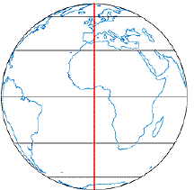
Now, travelling to the North Pole, I will talk about another map.

A Turkish Hadji Ahmad map of 1559 shows Alaska and Siberia as joined. While some people defend that the map maker had no space available to include the stretch of sea of Bering Strait between the two, the excellent quality of the map seems to prove otherwise.

However, if there was really no Bering Strait, the original map had to be more than 12.000 years ago, when Siberia and Alaska were joined by a land bridge at this location.

Funny stuff hem… J

(Don’t forget that although I write different themes in separate posts, you are free to, and should, combine them and extrapolate from it … or not)

Go and read more at:

“Maps of the Ancient Sea Kings” by Charles Hapgood

http://www.uwgb.edu/dutchs/PSEUDOSC/PiriRies.HTM

http://www.altarcheologie.nl/

Sunday, August 20, 2006

The Giza pyramids


Everybody knows the 3 big pyramids found in Cairo, Egypt. However, what I will say here you probably never heard about


So here go some facts:


1) The Pyramids of Orion


The Great Pyramid is situated at the centre of the Nile delta and the 3 pyramids form a mirror image of the Constellation of Orion. No only the pyramids but also the Sphinx were oriented to the constellation of Orion as it appeared in 10.500 BC (don’t forget that it is generally accepted that Egypt is one of the first modern civilizations and did not existed before 3.000 BC)


2) The Great Pyramid symbolizes the Earth … a round one.


The Greek grammarian Agatharchides of Cnidus, a tutor of one of Prolomeu Kings of Egipt, was told that, according to ancient tradition, one side of the base of the Great Pyramid was precisely 1/8 of a minute of a degree of the earth’s polar circumference. Each side of the Great Pyramid is 230 meters, and if you multiply by 8 to get one minute, and then by 60 (to get 1 hour), and then by 360 (considering that the world is a sphere) you get a result of 40.000 kilometers, an amazing accurate assessment of the polar circumference of the Earth.


230m × 8 × 60 (minutes) × 360º = 39.744Km


Questions:

- Did the Egyptians have the knowledge that the earth was round? And had also the notion of its size? (Don’t forget how much time after “we” accepted the earth was round and not flat)


3) Ancient Egyptian outstanding drilling machinery


By examining the blocks, used to build the pyramids, that had been hollowed out with some kind of drill in the Valley Temple, some researchers concluded that the rate at which the drill was cutting the block could not be achieved by hand work. Another strange observation is that the cutting though the quartz was faster than through feldspar (note that quartz is much more strong that feldspar).


Nowadays we can do that by using quartz crystals ultrasonic drills that produce ultrasonic sound, which enable them to drill faster through similar solids.


Does it mean that Egyptians used ultrasonic drill in Ancient Egypt?


4) Workers with precision equal to nowadays ophthalmologists.


The blocks of the Great Pyramid were cut to 0.01 tolerance (1/4 on an inch), which if you ask to any engineer they will say that that precision is almost superhuman.


Why would gigantic blocks need to be cut with that precision? And how?


5) The Great Pyramid, a sound box of the Earth orchestra


By recording the frequencies found inside the King chamber at the Great Pyramid, scientists found 4 resident frequencies, or notes, that are enhanced by the structure of the pyramid, and by he materials used in its construction. The notes form an F sharp cord, which according to ancient Egyptian texts were (and still are) the harmonic of our planet.

Also a sound made in any part of the pyramid is reflected with perfect acoustics in the King chamber, working as a sound box.


The Pyramid has several holes from the outside and from the inside that don’t lead anywhere. They have different materials in its construction. Was the pyramid constructed with sonic purposes?


There are some theories that all sacred places, as Stonehenge, have sonic purposes.


6) The Great Pyramid as a prime meridian


The Great Pyramid is not only located on the meridian that covers more land than any other, but it is also at the center of the earth’s land masses.

It is believed that the majority of the sacred places in the world are connected with the Great Pyramid meridian as well as the old (around 10.000 B.C.) North Pole, but that will be explain in a future specific post.


Read more at:

The Atlantis Blueprint: Unlocking the Ancient Mysteries of a Long-Lost Civilization by Colin Wilson, Rand Flem-Ath

(http://www.amazon.com/gp/product/0385334796/102-1163462-0633764?v=glance&n=283155)